Representative image
Vlorë is not just a beach base with a few nice walks nearby. It is one of the easiest places in Albania to move from sea level to serious mountain terrain


Vlorë is not just a beach base with a few nice walks nearby. It is one of the easiest places in Albania to move from sea level to serious mountain terrain in a single day, so hikers need real route planning, offline maps, water, and honest difficulty ratings.
The counter-intuitive truth is this, the prettiest Vlorë hikes are often not the easiest ones. The bay looks gentle from Lungomare, but the hills above Kaninë, the exposed roads near Orikum, and the high wind zones around Llogara Pass can turn a casual walk into a long day fast.
This guide is written for residents, remote workers, retirees, and new arrivals who want to hike safely from Vlorë without guessing. You will find route ideas, GPS starting points, map tools, seasonal advice, and a packing system that works for coastal paths and mountain trails.
The best hiking decision in Vlorë is made before your shoes touch dirt. Many newcomers look at the sea, the promenade, and the low green hills, then assume the area is easy. Some routes are easy, but the region changes fast once you leave the flat bay.
Vlorë sits on Albania’s southwestern coast, between the Adriatic and Ionian seas. The city is a port, a beach town, and a mountain gateway at the same time. Older district references give Rrethi i Vlorës a land area of 1,609 square kilometers, with a 2010 estimate of about 151,314 people. Latitude.to places Vlorë city near 40°28'0.01"N, 19°29'22.99"E.
That mix matters for hikers. You can start near the Bay of Vlorë, walk past cafés and apartments, then climb toward older villages and ridge viewpoints. You can drive south toward Orikum and Llogara, then reach pine forest and high pass conditions within the same morning.
Think of Vlorë hiking as a coastal-to-alpine scale. At one end, you have bay loops near Lungomare, Uji i Ftohtë, and the waterfront. In the middle, you have hillside routes toward Kaninë Castle and local ridges above the city. At the harder end, you have Llogara Pass, Karaburun, and long Orikum extensions.
A simple rating system helps. Easy routes are under 10 km, with very low climbing, and usually take one to three hours. Moderate routes are often 10 to 20 km, with 100 to 400 m of climb, and can take three to six hours. Difficult routes usually pass 15 km, climb more than 400 m, and include rocky, steep, or exposed sections.
Komoot lists more than 60 easy hikes in Vlorë, which is good news for beginners. But Outdooractive lists routes like the Kaninë Castle round trip at 16 km, with 414 m ascent and descent, and a suggested time of about 5 hours 10 minutes. That is not a beach stroll. It is a proper day hike.
Use time, not distance, as your first filter. A 9 km route near the bay can feel easy. A 9 km route on loose stone above the coast can feel much harder. Heat, wind, missing shade, and slippery winter mud can shift a route up one difficulty level.
For new residents, the safest first month looks like this. Start with the Bay of Vlorë loop. Move to the 11.2 km scenic route near the bay. Then try Kaninë Castle on a cool day. Save Llogara Pass until you have checked weather, transport, and offline maps.
This matters more if you live in Vlorë year-round. Locals often know which paths are dusty, which road sections feel unsafe on foot, and which hills bake in summer. New arrivals may only see a line on an app. A local comment over coffee near Lungomare can save you from a bad route choice.
Vlorë’s hiking appeal comes from its sharp terrain changes. Topographic data for the Vlorë area gives an average elevation near 124 m. That number can trick you, since the wider area includes flat urban zones and steep mountain approaches.
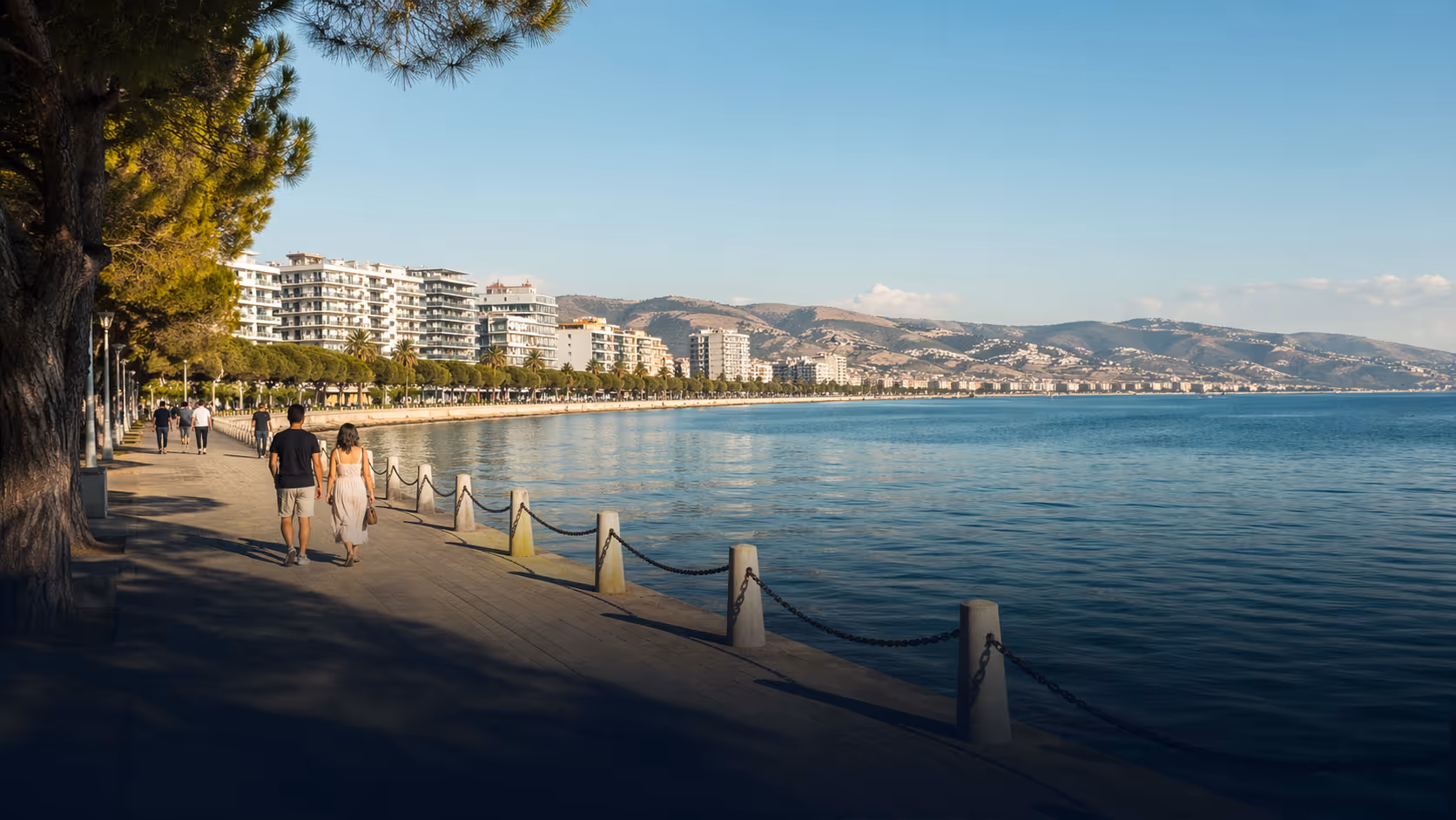
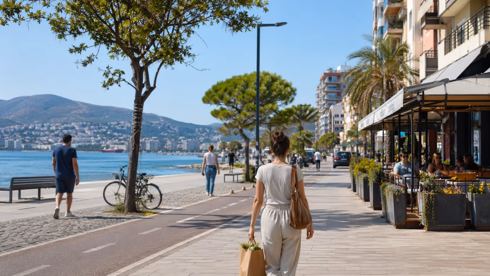
The city center sits close to sea level. The waterfront and Lungomare are friendly for warm-up walks, sunset loops, and recovery days. The surface is easy underfoot, water and food are close, and taxis are easy to find.
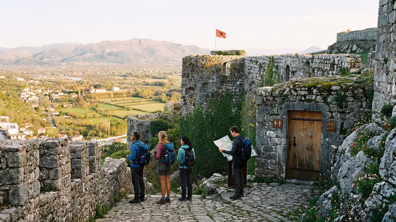
Move inland or south, and the feeling changes. Kaninë sits above Vlorë, with castle ruins, open views, and climbs that test calves fast. The elevation gain is not extreme by alpine standards, but it is enough to tire hikers who packed like they were going for a café walk.
Farther south, Orikum becomes a useful trail hub. Gaia GPS lists routes near Orikum, including longer road and trail segments that connect toward mountain terrain. Orikum itself is smaller than Vlorë, with research references placing its population around 5,503. That means fewer services once you move away from the main road.
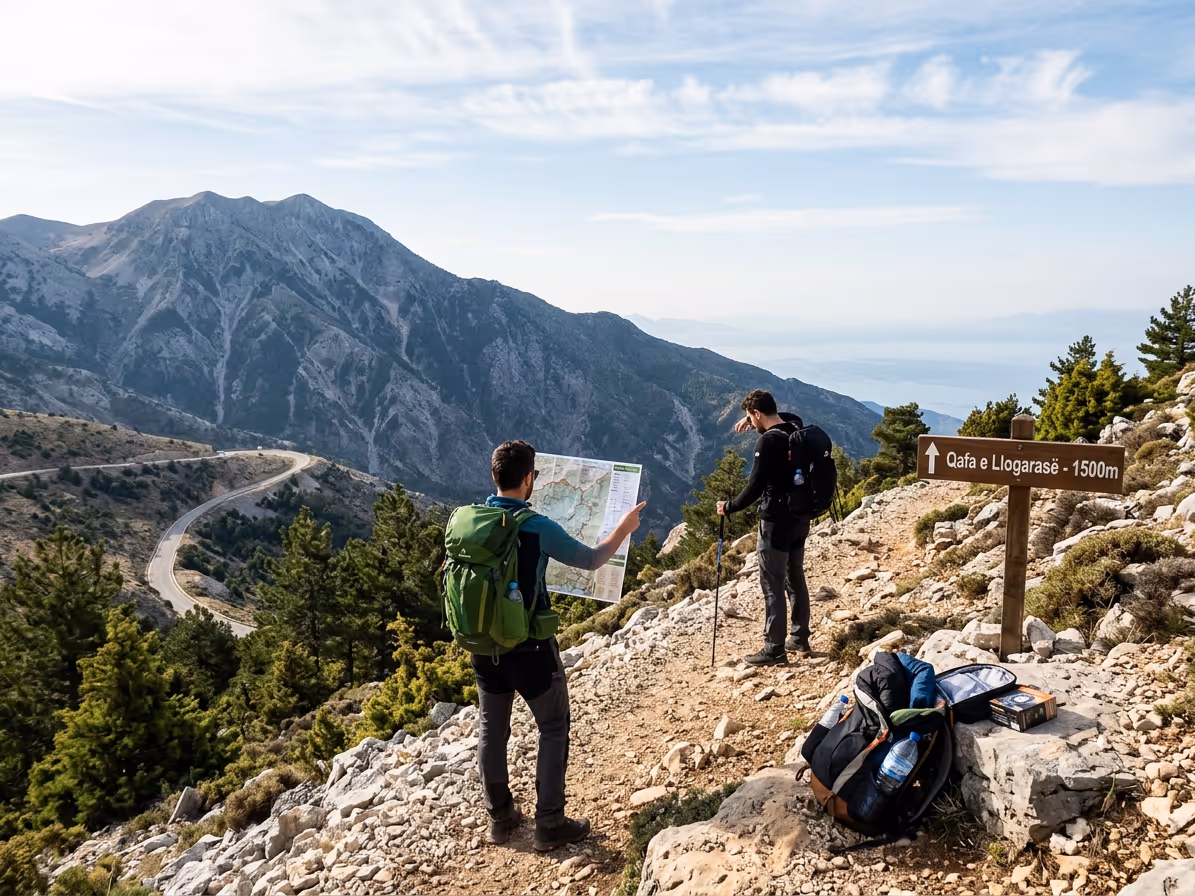
Llogara Pass is the big step up. It connects the coast with high mountain terrain along the route toward the Albanian Riviera. The pass is commonly linked with dramatic sea views, pine forest, sharp weather shifts, and stronger wind.
The Llogara area should not be treated like a simple viewpoint stop. A hike near the pass may include cooler air, sudden cloud, uneven stone, and sections with limited escape options. The drive from Vlorë on SH8 is part of the planning, since fatigue after the hike can matter on the return.
Karaburun Peninsula is a different kind of challenge. It is not only about elevation. It is about remoteness, sun exposure, rough access, and the need to stay on known routes. A bay may look close on a map, then take much longer on rocky terrain.
Sazan Island and protected coastal areas need extra care. Do not treat old military zones, abandoned structures, or rough tracks as open playgrounds. Stay on permitted paths and respect signs. If a local guide says a place is not for casual entry, listen.
The city’s position gives you rare variety. You can train on flat ground near the promenade, build strength on Kaninë, then test yourself near Llogara. This is what makes Vlorë valuable for residents, not only visitors.
It is tempting to chase the most dramatic route first. A better plan is to build a personal ladder. Each hike should teach you something about your pace, gear, heat tolerance, and map skills. That is how you get long-term freedom outdoors here.
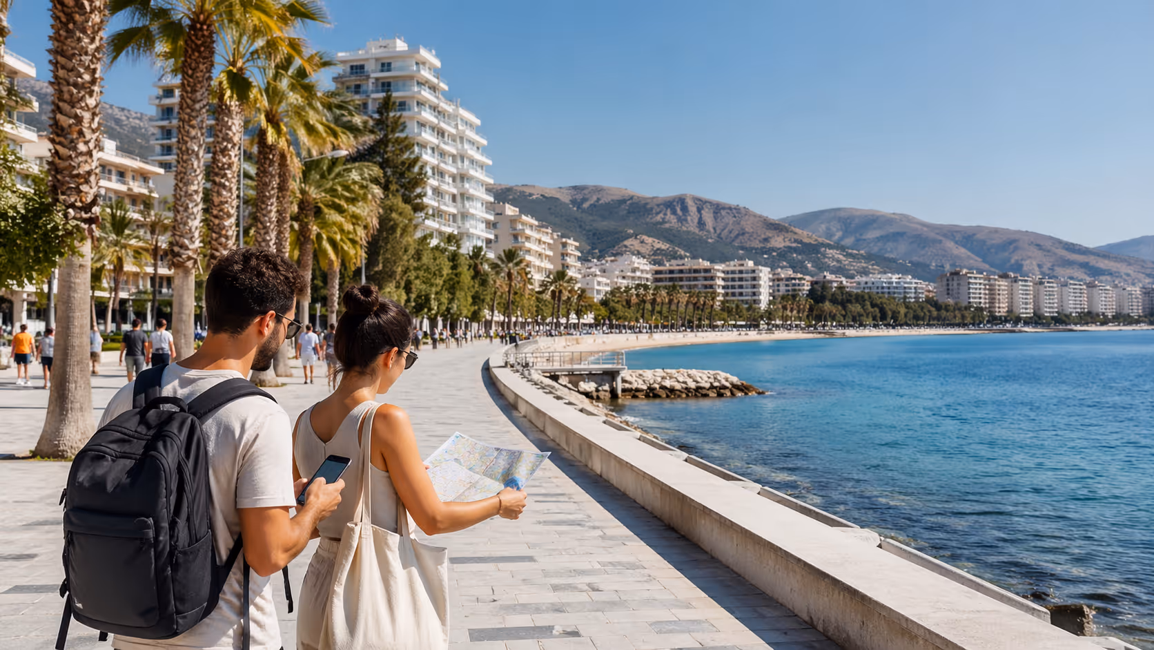
Use the route notes below as planning anchors, not as final GPS tracks. Trail lines shift, app data changes, and road access can change after storms or construction. Download the latest map before you leave your apartment in Skelë, the Old Town area, Uji i Ftohtë, or near Lungomare.
Start near the Bay of Vlorë, around 40.45°N, 19.48°E. This is the right first hike for most newcomers. Outdooractive lists a Bay of Vlorë loop at about 9.2 km, with only 16 m of elevation gain, and an estimated time of about 2 hours 20 minutes.
The route is easy-adjacent, but many apps still treat it as moderate. That is fair if you walk in summer heat, start late, or add side streets and viewpoints. The flat surface can feel simple, yet the sun can drain you.
Use this route to test your footwear. If your shoes rub near Lungomare, they will punish you on Kaninë. If your daypack feels heavy after 90 minutes, it will feel worse near Llogara.
Best use case, sunset training walk after work. Bring water, a light layer in spring or autumn, and a charged phone. It is a good social hike for new residents who want to meet people without committing to a full mountain day.
Outdooractive lists another Bay of Vlorë round trip at about 11.2 km, with 85 m of elevation gain, and an estimated time near 2 hours 50 minutes. This is a good next step after the shorter loop.
It adds more movement, more time on foot, and a little more climbing. The difficulty is still manageable for fit beginners. It is best in spring, autumn, or early morning during summer.
Start from the waterfront area, then follow the mapped loop in your app. Check if your route uses sidewalks, road shoulders, or hillside streets. Some segments can feel less pleasant during traffic peaks.
This route works well for remote workers who sit too much during the week. Do it after a half workday, then finish near Lungomare for dinner. Keep your pace steady rather than treating the first flat section like a race.
Kaninë Castle is one of Vlorë’s best history-meets-hiking routes. Outdooractive lists the round trip at about 16 km, with 414 m of ascent and descent, and an estimated time of 5 hours 10 minutes. Treat this as difficult if you are new to hiking.
The route pattern is simple to understand. You start near the bay or lower city, then climb toward Kaninë and the castle area. The reward is a broad look over Vlorë, the bay, and the surrounding hills.
The hard part is the climb, not the distance alone. A 414 m gain can feel tough under direct sun. The descent can be rough on knees, mainly if you rush.
Families can adapt the route by doing only the lower section or taking transport closer to Kaninë. Strong hikers can do the full round trip. For residents, this is a useful fitness benchmark.
Start early from Skelë or the lower city if walking the full route. Carry at least 2 liters of water in mild weather, and closer to 3 liters in summer. Do not count on every hillside shop or café being open.
Llogara Pass is the classic mountain goal from Vlorë. It sits south of the city along SH8, on the route toward the Riviera. Use an approximate planning anchor near 40.5°N, 19.5°E, then open Outdooractive or Gaia GPS for exact trail points.
The usual pattern is drive from Vlorë, park near a known access point, then hike into forest, ridges, or viewpoints. Depending on your chosen track, this can range from moderate to difficult. Expect bigger elevation changes than the bay routes.
Llogara can feel like a different country compared with Lungomare. The air can be cooler, wind can be stronger, and cloud can build fast. Layers matter here, even when Vlorë city feels hot.
Do not start late. A delayed start near Llogara can push your descent into poor light. Add time for the drive back to Vlorë, plus food, rest, and road conditions.
This is a route type where trekking poles are useful. They help on loose ground, and they reduce knee strain on descents. Bring a headlamp, not just a phone torch.
Gaia GPS lists a 37.3 mile one-way route near Orikum linked with SH74. This is not a casual day outing for most hikers. Treat it as an advanced plan or a multi-day route concept.
Orikum is a practical base south of Vlorë. It gives access to coastal and mountain approaches, with fewer urban services than Vlorë city. Plan food, water, transport, and exit points before starting.
Long road-linked routes can be mentally tiring. Asphalt, traffic exposure, heat, and limited shade can drain energy. A route may look simple on a map, then feel harder under sun.
If you want a taste of this area, start with a short out-and-back from Orikum. Mark your turn-around time before you leave. If you are not halfway to your planned point by that time, turn back.
Karaburun is for hikers who respect heat, rough access, and protected nature. Use an approximate planning anchor around 40.6°N, 19.2°E, then choose a mapped route from a trusted app or a local guide. Do not improvise across rough ground.
The peninsula has secluded bays and wild coastal sections. That beauty comes with fewer services. Water, shade, phone signal, and transport can all be limited.
Sustainable hiking matters here. Stay on known tracks, pack out all waste, and do not disturb wildlife. UNDP Albania’s EU4Nature work highlights the value of protecting Albania’s natural heritage, and Karaburun is the type of place where low-impact habits are not optional.
Karaburun is best done with a plan shared with someone in Vlorë. Tell a friend your route, start time, and return time. If you are new in town, Join the community and ask who has walked the area recently.
Dhërmi sits farther south, past Llogara, and works well as a culture and hiking day. The route pattern is village lanes, hillside paths, sea views, and beach access. It is a different style from Kaninë or the bay.
The main issue is logistics. Travel time from Vlorë adds fatigue, mainly if you drive back after sunset. Parking, summer traffic, and heat can shift the day.
For a first trip, keep the hike short. Use Dhërmi as a mixed day with a village walk, a marked path, and a long rest. Save harder ridge routes for cooler months.
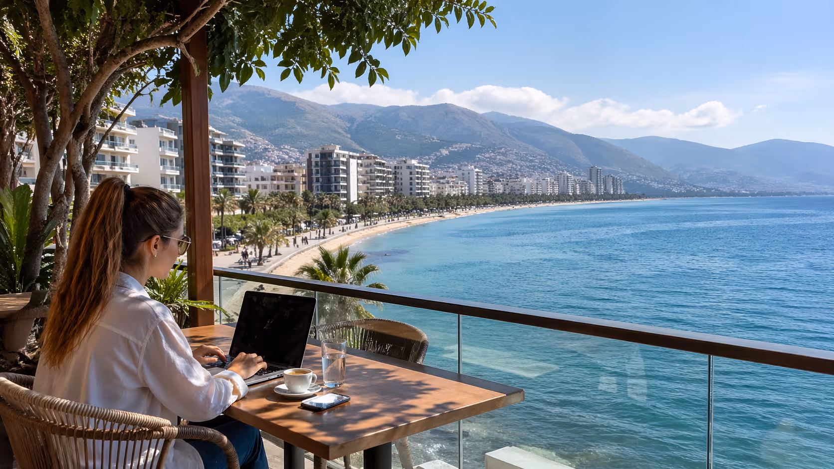
Your phone is a tool, not a safety plan by itself. In Vlorë, you may have strong signal near the promenade and weak coverage on a ridge or remote coastal track. The smarter move is to set up maps before leaving home.
Outdooractive is useful for Vlorë-specific hiking routes. It gives distances, times, elevation gain, and user route data. Use it for Bay of Vlorë, Kaninë, and Llogara planning.
Gaia GPS is strong for GPS-based route work. It is useful near Orikum and for longer tracks where you need offline layers. If you are planning the SH74 extension, Gaia GPS should be part of your map setup.
Komoot is helpful for easy route filtering. Since it lists more than 60 easy hikes in Vlorë, it is good for building confidence. Use it when you want lower-risk walks near the city or gentle hills.
Trailforks maps 61 trails in the Vlorë region, with a mountain bike focus. Many of those tracks can interest hikers too, but check trail use before walking. A downhill bike trail is not always a good walking choice.
Avenza Maps is valuable for offline map files. It can help when you need a map that works without signal. For off-road areas, offline access is not a luxury.
Topographic-map.com is useful before the hike. Study elevation, slope, and terrain bounds in advance. It helps you see if a route climbs steadily, drops into a valley, or crosses steep ground.
Use this simple map workflow. Pick the route on one main app. Cross-check the length and elevation on a second source. Download the offline map. Save the start point, turn-around point, and exit points. Screenshot the route summary.
Do not rely on blue-dot confidence. A GPS dot can drift near cliffs, forest, or tight valleys. If the trail and the dot disagree, stop and check the wider map. Do not keep walking just to make the dot feel right.
Carry a power bank on any hike over three hours. Heat drains batteries. Cold near Llogara can drain them too. Keep your phone out of direct sun when you stop.
For group hikes, ask everyone to download the route. One person with the map is a weak plan. If the group splits or the phone fails, the whole day becomes harder.
If you live in Vlorë, build a personal saved map library. Save Lungomare start points, Kaninë access, Orikum parking, and Llogara meeting spots. After a few hikes, the city starts to feel connected rather than confusing.
A Vlorë daypack should work across four conditions, sun, wind, rain, and stone. The same week can bring beach heat in the city and cold gusts near Llogara. Pack for the route you are doing, not the weather you see from your balcony.
Use the BASE system, Basics, Apparel, Safety, Environment. It keeps packing simple and avoids the two classic mistakes, too little water and the wrong shoes.
Carry water first. For summer hikes, plan up to 3 liters per person for longer or exposed routes. For short bay walks, a smaller amount may be fine, but do not leave with only a tiny bottle if you plan to climb.
Bring salty snacks and slow energy food. Nuts, fruit, bread, cheese, or a sandwich from a bakery near Skelë can work. The point is to avoid a sugar spike followed by a tired climb.
Carry your offline map, power bank, ID, and a small amount of cash in Albanian lek. Some small places outside the city may not take cards. A taxi back from a route edge is easier if you have cash.
Wear proper shoes. For Lungomare and flat bay loops, trainers may be fine. For Kaninë, Llogara, Orikum, and Karaburun, use hiking shoes or boots with grip.
Choose layers. A light moisture-wicking shirt helps in heat. A fleece or warm layer helps near Llogara. A rain shell matters in spring, autumn, and winter.
Bring sun gear. A hat, sunglasses, and sunscreen are not optional on exposed coastal routes. Karaburun and Orikum can feel hotter than the forecast suggests.
Avoid new shoes on Kaninë or Llogara. Test them on the Bay of Vlorë loop first. Blisters are easier to solve near Lungomare than halfway down a rocky path.
Carry a small first aid kit. Include blister care, bandage, pain relief, antiseptic wipes, and any personal medicine. If you use allergy medicine, carry it rather than assuming you can buy it near a trail.
Bring a headlamp. A phone light is a poor backup when the battery is low. A small headlamp weighs little and gives you hands-free light if a hike runs late.
Carry a whistle and a light emergency layer. Wind can make shouting useless. An emergency blanket or thin spare layer can help if someone twists an ankle and must wait.
Trekking poles are useful on Llogara, Kaninë descents, and loose coastal tracks. They are not only for older hikers. They help balance and reduce stress on knees.
Pack out all waste. Bring a small waste bag, then carry it back to Vlorë. Do not leave fruit peels, tissues, or cigarette ends on trails.
Stay on marked or known tracks in sensitive areas. Karaburun, Sazan, and remote coastal zones need extra care. The goal is to enjoy nature without leaving damage behind.
Keep noise low in rural or protected areas. Local people may be working land, tending animals, or resting. A good hiker is welcome partly since they do not act like the whole hillside is a private stage.
Do not pick plants or disturb animals. Spring flowers near Llogara may be beautiful, but they belong there. Take photos, not pieces of the trail.
Vlorë is hikeable in every season, but not every route is smart in every season. The sea can make the city feel mild, then the hills can deliver mud, heat, or wind. Match your route to the month.
Spring is one of the best times for Kaninë, Llogara, and longer bay routes. Temperatures are more forgiving, hills are greener, and longer climbs feel less punishing. The light is good for views over the bay.
Spring can bring rain and slippery ground. Pack a rain shell, check the forecast, and assume mud after wet days. A route that is easy on dry stone may become slow after rain.
Llogara can still feel cold in spring. Do not dress only for Vlorë city. If you leave from a sunny café near Lungomare, pack a warm layer anyway.
Summer rewards early starters. Begin at sunrise or early morning for Kaninë, Orikum, and exposed coastal routes. Avoid long uphill sections during peak heat.
Bay walks are still useful in summer, mainly at sunset. The 9.2 km Bay of Vlorë loop can become a pleasant evening routine. Carry water, even for familiar routes.
Llogara may offer cooler air, but do not treat it as risk-free. Sun exposure, wind, and dehydration still matter. Heat can affect your drive, patience, and decision-making.
Karaburun in summer needs serious caution. Exposed stone, limited shade, and remote bays can drain water fast. Go with a clear plan, not a vague idea.
Autumn may be the most comfortable season for longer hikes. The sea is still warm, the city is calmer than peak summer, and hill routes become more pleasant. It is a good time to try Kaninë fully.
Weather shifts can arrive fast. Carry a shell and check the forecast for both Vlorë and Llogara. Mountain conditions may not match the city.
Autumn is good for residents who want routine. A Saturday Kaninë hike, a Sunday bay recovery walk, and a monthly Llogara outing can build fitness without overdoing it.
Winter in Vlorë is not deep alpine winter in the city. But hills can be wet, roads can be slick, and high routes can feel harsh. Mud and poor visibility are the main concerns.
Keep winter hikes shorter. Choose bay loops, lower hillside routes, and known paths. Save long Llogara or Karaburun plans for stable weather windows.
Waterproof footwear helps. A rain jacket and dry spare layer can turn a cold wet day from miserable to manageable. Start early, since daylight is shorter.
Winter is a good time to work on map skills. Study routes at home, build saved points, and walk lower paths. When spring arrives, you will be ready for bigger days.
The romantic idea is easy to understand. You move to Vlorë, finish work early, walk into hills above the sea, and feel free. The daily reality is less glossy, and that is not a bad thing.
Living in Albania means outdoor life is close, but planning is still your job. Some trails are well marked, some are informal, and some road sections are not built with hikers in mind. Weather can change, dogs may guard rural properties, and services thin out fast outside the city.
The most common mistake is overconfidence. New hikers see a moderate rating and focus only on distance. They ignore climb, terrain, shade, heat, and descent.
Kaninë is the classic example. A 16 km round trip with 414 m of climbing is within reach for many people. But it becomes unpleasant if you start at noon in July with one small water bottle.
Llogara brings a different risk profile. Wind, cold, cloud, loose footing, and longer distances can combine. A route that feels clear at the start can become harder once visibility drops.
Karaburun adds remoteness. If you twist an ankle on a busy bay path, help is close. If you twist it on a rough coastal track, the day becomes much more serious.
Orikum and SH74-style extensions add road exposure and distance. Long one-way routes require transport planning. Do not assume you can always flag a ride back.
Use a turn-around rule. Before the hike, choose a time when you will turn back no matter what. If you reach that time without reaching your planned point, return.
Share your plan. Send your route, start time, and expected finish time to a friend in Vlorë. If you live alone, this habit is one of the simplest safety upgrades you can make.
Watch your descent. Many slips happen after the viewpoint, when people relax. Slow down on loose stone, wet paths, and tired legs.
Respect dogs and livestock. Give animals space. Do not walk through private-looking land just since the map line appears to pass there.
Keep your group pace honest. A group is only as fast as its least prepared hiker. If someone is struggling near Kaninë, do not push them toward Llogara next weekend.
Know when to cancel. Rain, high wind, extreme heat, poor sleep, or a dead phone battery are valid reasons to change plans. The mountain will still be there next week.
Vlorë’s nature is not a backdrop for social media. It is where people live, work, farm, fish, graze animals, and build weekend rituals. Hiking well means moving through these places with care.
Stay on existing tracks where possible. Cutting switchbacks damages soil and makes erosion worse. On coastal paths, it can scar fragile ground.
Pack out waste from every route. This includes tissues, food wrappers, orange peels, and broken gear. If you brought it from Vlorë, take it back to Vlorë.
Support local businesses near trailheads. Buy water in Orikum, coffee near Kaninë, or lunch in a village after a hike. This keeps hiking connected to local life rather than turning it into a one-way extractive visit.
Ask before photographing people, homes, or private land. A view over the bay is fair. A person’s courtyard is not yours to record without permission.
Keep music off speakers. Sound travels in open hills and protected areas. Use headphones at low volume if you need audio, but keep enough awareness for bikes, dogs, cars, and other hikers.
Use marked parking areas or obvious public spaces. Do not block farm tracks, gates, or village lanes. A badly parked car can turn hikers into a nuisance fast.
Be careful with fire. Dry summer grass and wind are a bad mix. Do not light fires unless you are in a permitted, controlled place.
Learn a few Albanian phrases. “Mirëdita” for good day and “faleminderit” for thank you go a long way. Friendly greetings can soften language barriers in villages and rural edges.
Sustainable hiking is not only about nature. It is about fitting into the place. Vlorë is easier to enjoy when residents, newcomers, and local families all feel respected on the same paths.
Here is the host tip we give newcomers at Vlore Circle, do your first three hikes close to the city before chasing Llogara photos. Walk the Bay of Vlorë loop, then the longer bay round trip, then Kaninë Castle on a cool morning. After that, you will understand your pace, shoes, water needs, and comfort with local terrain.
This advice sounds conservative, but it works. Many people arrive in Vlorë with energy and big plans. The ones who keep hiking all year are usually the ones who start steady.
If you are new to the city, use the promenade as your outdoor classroom. Lungomare teaches pace, sun exposure, shoe comfort, and how your body handles distance. It is close to cafés, pharmacies, taxis, and home.
Then use Kaninë as your first serious test. It has enough climb to matter, a clear cultural reward, and a direct link to Vlorë’s history. It is hard enough to respect, but not so remote that every mistake becomes serious.
Save Llogara for a day when you have no work pressure later. Do not squeeze it between meetings. Mountain days need mental space.
Ask people who hike here often. Conditions change, and local memory is useful. A resident may know if a road section is unpleasant, if a path is overgrown, or if a route is better started from a different point.
If you feel isolated in town, hiking can help. Join the community, come to a meetup, and ask who wants an easy Saturday walk near the bay. It is much safer and more fun to build your outdoor circle slowly.
A final local note, do not let perfect gear stop you from starting. You need safe shoes, water, sun protection, and a map. You do not need to dress like you are crossing the Alps for a bay loop.
But do not let casual city life make you careless either. Vlorë gives you beaches, hills, and mountains close together. That gift deserves preparation.
Vlorë rewards hikers who move with curiosity, patience, and respect for the terrain.
Follow Vlore Circle for fresh guides, local updates, and community notes around life in Vlorë. It is the easiest way to stay close to what we are building.


Be part of a growing community built around connection, local life, and a better experience of Vlorë.
join the circle